Subdivisions and Residential Developments
 Axis Land Surveying Ltd. specializes in all aspects of subdivision and residential development surveys. From initial subdivision plans for municipal or provincial applications to final plans filed in the Land Title Office, we handle every step with precision and expertise.
Our team collaborates with developers, engineers, architects, and solicitors to provide essential services like topographical surveys for engineering, boundary monument surveys to confirm property perimeters, and subdivision design reviews to meet municipal zoning requirements. We prepare draft plans for municipal and solicitor approval to streamline the subdivision process.
Every subdivision and residential development is unique, and each local government has its own requirements for planning, building, and zoning. With extensive experience across municipalities, we navigate these complexities to ensure your project meets all engineering, environmental, and zoning standards, helping you move forward with confidence.
Contact us today to discuss how we can support your subdivision or residential development from start to finish.
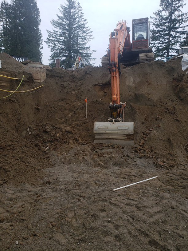
Land Development: Subdivision & Legal Surveys
A Legal Land Survey defines and marks property boundaries, whether for consolidating parcels, re-establishing existing boundaries, or creating new ones for subdivisions. If you plan to subdivide, develop a strata, or pursue other legal land uses, a British Columbia Land Surveyor is essential for accurate, compliant boundary surveys.
Types of Legal Surveys We Offer:
- Boundary staking and re-posting
- Statutory rights of way, easements, and covenants
- Roads, highways, and railways
- Crown land acquisition and tenure
- Park boundary establishment
- Natural boundary definition and accretion
Contact us to learn how our expert team can assist with your land development needs.
Easements, Statutory Right of Ways, and Covenants
Easement, Right of Way, or Covenant plans are prepared to accompany an agreement document between a property owner and an individual, company, or municipality. These agreement documents are typically registered on the property title as a charge and may restrict the right to use all or part of the property owner’s land for the purpose specified in the document.
These documents may be positive or negative in nature, permitting or restricting rights to use portions of land referred to in the document and plan.
Axis Land Surveying Ltd. can provide advice on cost effective ways to achieve your desired requirements.
It is an easement that deals with the encroachment of one property owner’s rights over another. If your driveway (dominant tenement) is on your neighbour’s property (servient tenement), you would need an easement over their property to secure your rights to that piece of property. In addition to protecting the right of passage through large buildings from one property owner to another, easements are also used to protect property boundaries. Developers of strata properties often enter inro easement agreements granting future strata owners’ access to shared facilities before the strata’s are incorporated.
Building Lease Plans
 Axis Land Surveying Ltd. provides survey services for measurement, calculation of lease areas and preparation of plans.
In addition to a lease document, a lease survey plan is prepared to accurately define a specific area of land or building. The lease document specifies the terms of the lease, such as the duration and purpose of the lease.
Sketch plans are prepared for leases shorter than three years that are not going to be registered in the Land Title Office. Sketch plans may or may not be prepared to BOMA (Building Owners and Managers Association) standards depending on the current lease definition or the needs of the owner and tenant.
Lease plans are prepared for the purpose of filing the plan and lease document in the Land Title Office and will show the location of the lease in the building and the location of the building relative to the boundaries of the lot. After understanding your needs and your situation, we will advise you on your lease plan requirements, and how best to apply guidelines. The landlord and tenant(s) need to agree on the method of measurement, and what should or should not be included in the calculations.
Air Space and Volumetric Interest
Air space subdivisions are becoming increasingly more common in mixed-use buildings to separate ownership between the residential and non-residential areas of the building. Air Space plans are particularly important in the development of high-rise buildings because they create separate lots within a development. The title to a piece of land goes above and below the surface of a property; therefore, conventional subdivisions do not have vertical limits and cannot be subdivided into three dimensional shapes with defined limits. An air space parcel can be created to give a new title to a certain part of the development, which can be further subdivided by a strata plan.
Axis Land Surveying Ltd. can help in developing the Air Space surveys and plans that are required from several commercial and residential developments. We are familiar with municipal planning requirements and current policies and legislation governing strata subdivisions and air space titles for both residential and commercial-scale projects. If you need help surveying 3D spaces and air space parcels, we’re experienced and ready to help you with your next surveying project and filing with the Land Title Office. Our techniques and expertise ensure maximum efficiency on each project.
